Log in
All resources
Create a design
485 Free Images of Pictorial Maps
maps in the library of congress
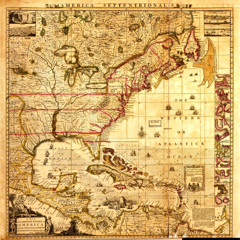
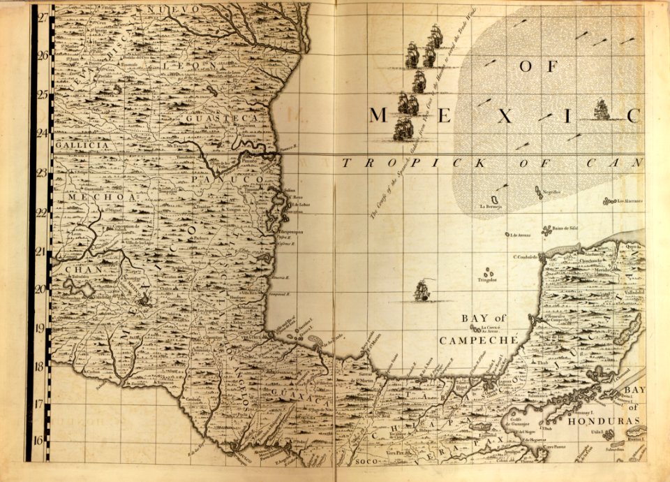
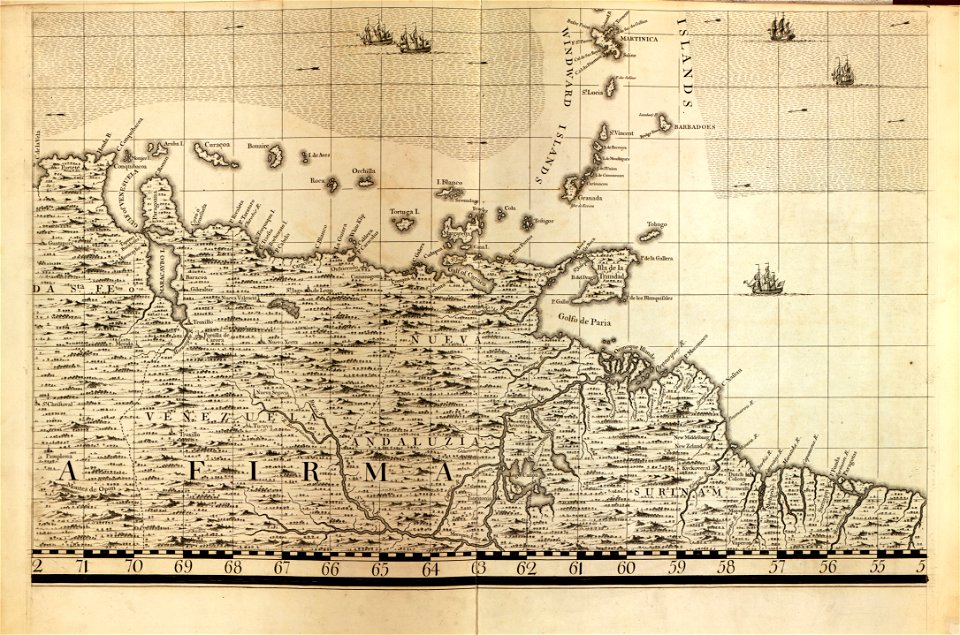
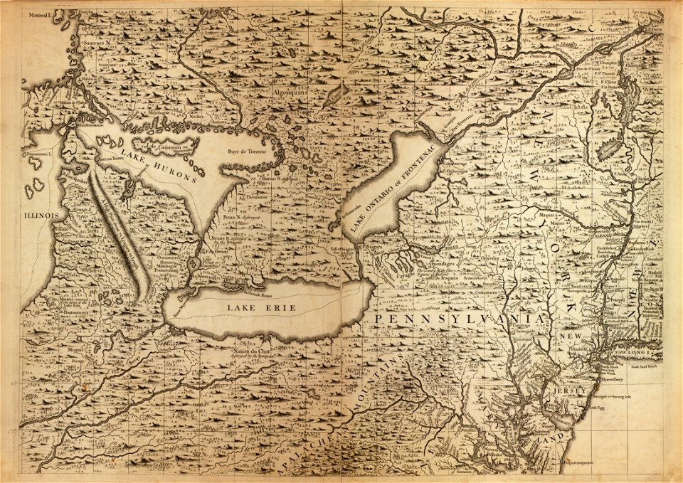
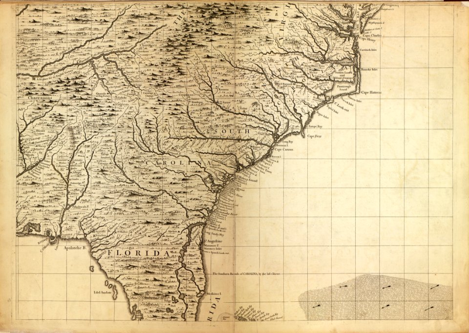
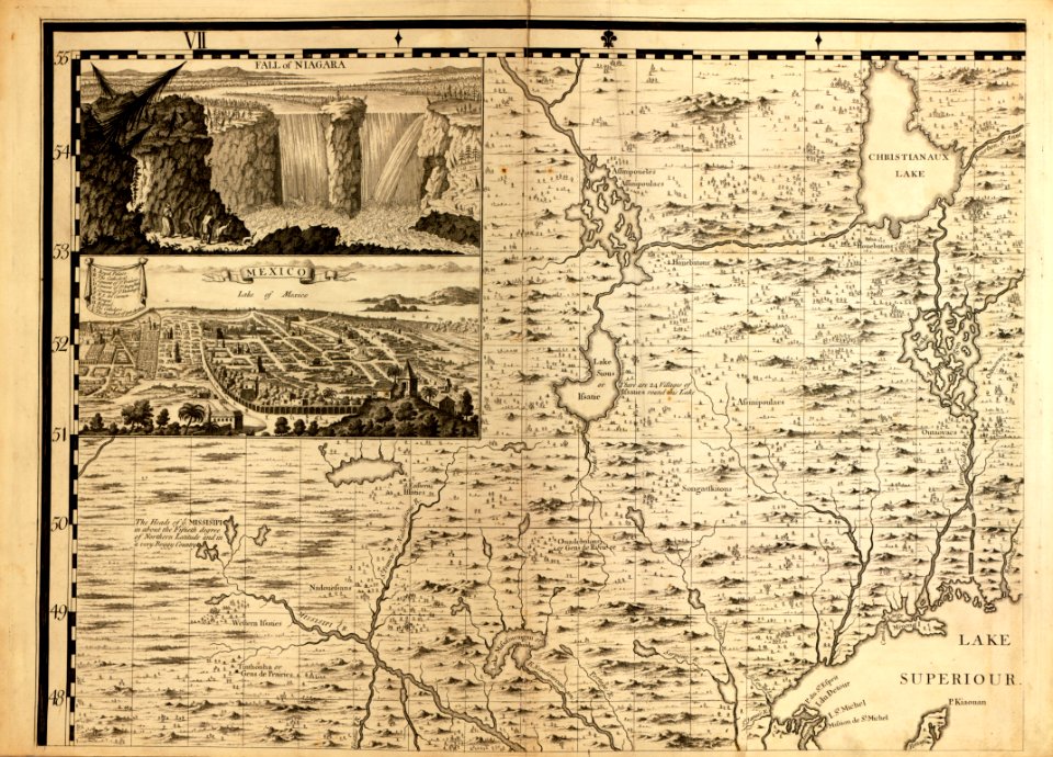
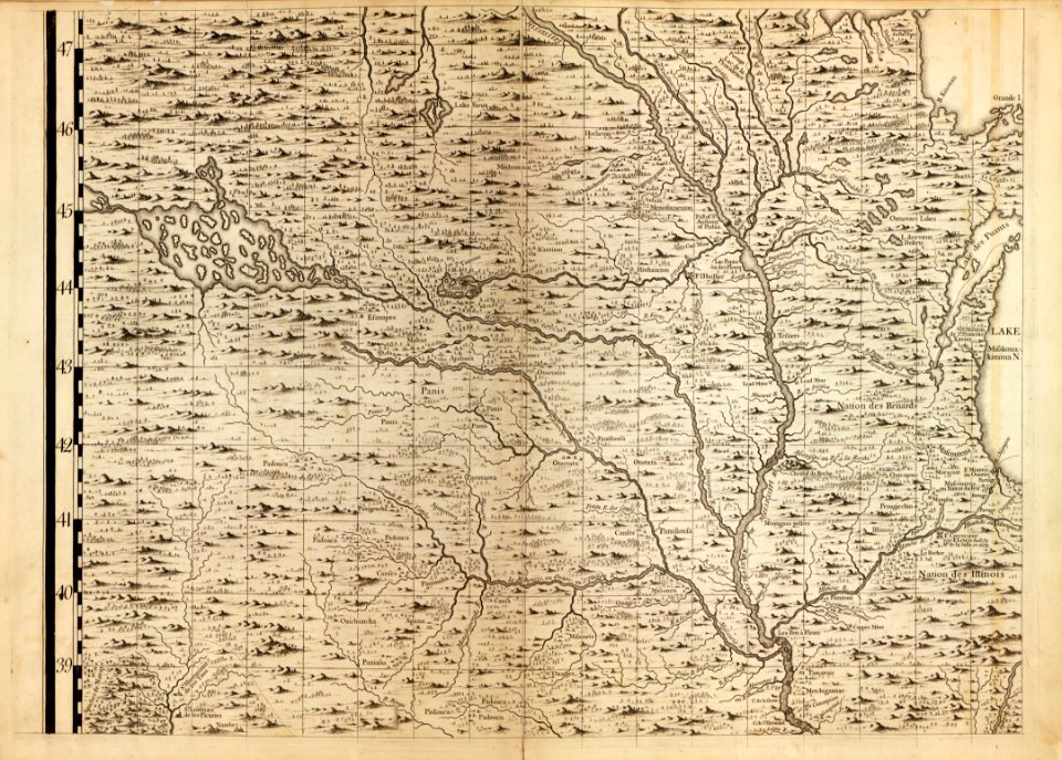
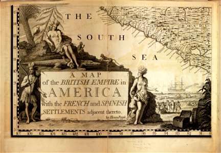
a map of the british empire in america with the french and spanish settlements adjacent thereto
lawrence h. slaughter collection of english maps, charts, globes, books and atlases
walter riemer (illustrator)
pictorial maps of germany
nazi germany in art
walter riemer
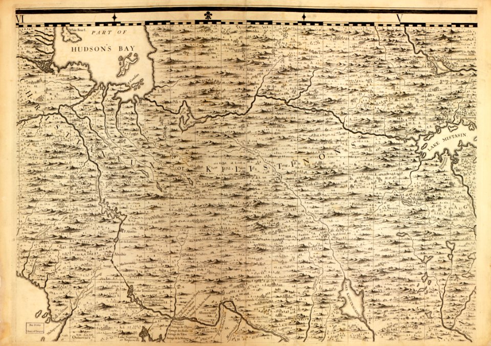
maps of north america
tourism advertising posters of germany
emanuel bowen
world war ii posters from the united kingdom
her majesty's stationery office collection
tourism advertising posters of germany
german-language maps of germany
sanson maps of south america
1719 maps of south america
maps in the library of congress
1750s maps of cuba
maps in the library of congress
1650s maps of cuba
maps by jodocus hondius
maps by petrus bertius
maps in the library of congress
1760s maps of china
maps facing east
anton wied
merian plan of paris
baroque
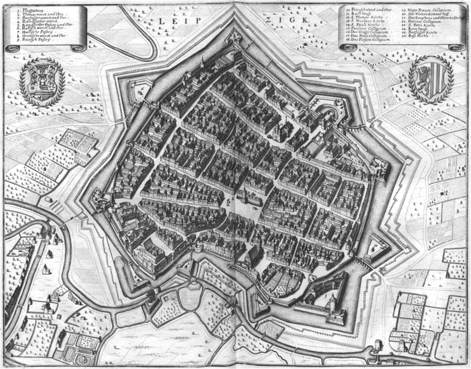
leipzig in the 17th century
baroque
media contributed by cleveland public library
georg widmann
tourism advertising posters of germany
1938 maps of germany
tourism advertising posters of germany
1935 maps of germany
maps of the kingdom of kongo
maps by petrus bertius
kanonenteich (leipzig)
adolf eltzner
lawrence h. slaughter collection of english maps, charts, globes, books and atlases
1640s maps of the americas
merian plan of paris
baroque
maps of the ganges river
old maps of bengal
maps of the kingdom of kongo
maps by jodocus hondius
maps by gerard de jode
1593 maps
maps by willem and johannes blaeu
1635 maps of africa
maps in the library of congress
old maps of yunnan
lawrence h. slaughter collection of english maps, charts, globes, books and atlases
nypl lionel pincus and princess firyal map division
maps in the library of congress
1877 maps of the united states
maps in the library of congress
1758 maps
maps in the library of congress
1792 maps of africa
18th-century maps of new orleans
maps in the library of congress
maps in the library of congress
18th-century maps of jamaica
bodleian maps collection
pictorial maps
maps in the library of congress
1780s maps of the caribbean
lawrence h. slaughter collection of english maps, charts, globes, books and atlases
nypl lionel pincus and princess firyal map division
old maps of the new kingdom of granada
maps by willem and johannes blaeu
maps in the library of congress
1747 maps of new jersey
maps by emanuel bowen
1747 maps of africa
maps in the library of congress
1768 maps of north america
maps by willem and johannes blaeu
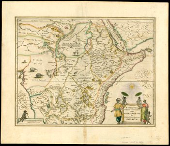
1650s maps of ethiopia
maps in the library of congress
1763 maps of north america
maps in the library of congress
1639 maps of the caribbean
engravings of topographia superioris saxoniae, thüringiae, misniae et lusatiae (merian)
baroque
lawrence h. slaughter collection of english maps, charts, globes, books and atlases
nypl lionel pincus and princess firyal map division
maps of luzy (nièvre)
amédée jullien
old maps of castilla la nueva
1765 maps of spain
maps in the library of congress
1718 maps
david rumsey historical map collection
1790s maps of the holy roman empire
maps in the library of congress
1639 maps of cuba
a map of the british empire in america with the french and spanish settlements adjacent thereto
maps in the library of congress
a map of the british empire in america with the french and spanish settlements adjacent thereto
maps in the library of congress
maps in the library of congress
1713 maps
maps in the library of congress
1755 maps
lawrence h. slaughter collection of english maps, charts, globes, books and atlases
covens en mortier
maps of paris from the david rumsey historical map collection
maps of paris by caspar merian
description
historical
maps by willem and johannes blaeu
1635 maps
maps in the library of congress
1690s maps of the world
a map of the provinces of new york and new jersey, with a part of pennsylvania and the province of quebec
maps in the library of congress
maps in the rijksmuseum amsterdam
1820s maps of europe
lawrence h. slaughter collection of english maps, charts, globes, books and atlases
novi belgii, atlas maior
david rumsey historical map collection
1790s maps of the holy roman empire
maps in the library of congress
1765 maps
chicago and the midwest, newberry library
old maps of the mississippi river
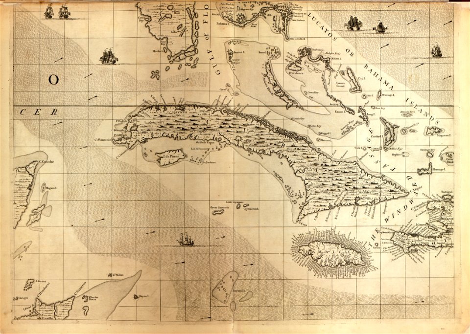
a map of the british empire in america with the french and spanish settlements adjacent thereto
maps in the library of congress
a map of the british empire in america with the french and spanish settlements adjacent thereto
maps in the library of congress
a map of the british empire in america with the french and spanish settlements adjacent thereto
maps in the library of congress
a map of the british empire in america with the french and spanish settlements adjacent thereto
maps in the library of congress
a map of the british empire in america with the french and spanish settlements adjacent thereto
maps in the library of congress
maps in the library of congress
1721 maps
walter riemer (illustrator)
pictorial maps of germany
maps by richard william seale
1740s maps of south america
geografia tavole moderne di geografia de la maggior parte del mondo di diversi avtori raccolte et messe secondo l'ordine di tolomeo con i disegni di molte città et fortezze di diverse provintie
maps in the library of congress
maps by hendrik hondius the younger
1631 maps of africa
a map of the provinces of new york and new jersey, with a part of pennsylvania and the province of quebec
lawrence h. slaughter collection of english maps, charts, globes, books and atlases
history of yokohama
maps of yokohama
lawrence h. slaughter collection of english maps, charts, globes, books and atlases
1700s maps of north america
maps in the library of congress
1660s maps of the americas
old maps of the london underground
maps by macdonald gill
maps in the library of congress
1771 maps of north america
a map of the british empire in america with the french and spanish settlements adjacent thereto
maps in the library of congress
a map of the british empire in america with the french and spanish settlements adjacent thereto
maps in the library of congress
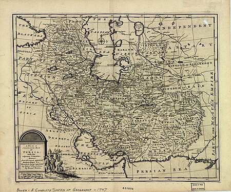
1747 persia map by emanuel bowen
maps in the library of congress
tourism advertising posters of germany
germany in the 1930s
tourism advertising posters of germany
germany in the 1930s
plants
maps
lawrence h. slaughter collection of english maps, charts, globes, books and atlases
covens en mortier
maps in the library of congress
1744 maps
a map of the provinces of new york and new jersey, with a part of pennsylvania and the province of quebec
maps in the library of congress
maps in the library of congress
1770s maps showing history
maps in the library of congress
1771 maps of north america
a map of the british empire in america with the french and spanish settlements adjacent thereto
maps in the library of congress
a map of the british empire in america with the french and spanish settlements adjacent thereto
maps in the library of congress
maps in the library of congress
old maps of latin america
a map of the british empire in america with the french and spanish settlements adjacent thereto
maps in the library of congress
a map of the british empire in america with the french and spanish settlements adjacent thereto
maps in the library of congress
a map of the british empire in america with the french and spanish settlements adjacent thereto
maps in the library of congress
a map of the british empire in america with the french and spanish settlements adjacent thereto
maps in the library of congress
a map of the british empire in america with the french and spanish settlements adjacent thereto
maps in the library of congress
a map of the british empire in america with the french and spanish settlements adjacent thereto
maps in the library of congress
a map of the british empire in america with the french and spanish settlements adjacent thereto
maps in the library of congress
a map of the british empire in america with the french and spanish settlements adjacent thereto
maps in the library of congress
a map of the british empire in america with the french and spanish settlements adjacent thereto
maps in the library of congress
a map of the british empire in america with the french and spanish settlements adjacent thereto
maps in the library of congress
201 - 300 of 485
Next page
/ 5


![[Map of a part of the island of Cuba and of the Bahamas]., Johannes Vingboons, 1650](https://cdn.creazilla.com/illustrations/7019884/map-of-a-part-of-the-island-of-cuba-and-of-the-bahamas-loc-00560610-illustration-md.jpeg)


![TERRA FIRMA et NOVUM REGNUM GRANATENSE et POPAYAN., [1630-1670]](https://cdn.creazilla.com/illustrations/10001462419/terra-firma-et-novum-regnum-granatense-et-popayan-1630-1670-md.jpg)


![[Map of the islands of Hispaniola and Puerto Rico]., Johannes Vingboons, 1639](https://cdn.creazilla.com/illustrations/6627413/map-of-the-islands-of-hispaniola-and-puerto-rico-loc-2003623402-illustration-md.jpeg)


![[Map of the complete island of Cuba]., Johannes Vingboons, 1639](https://cdn.creazilla.com/illustrations/6627474/map-of-the-complete-island-of-cuba-loc-2003623399-illustration-sm.jpeg)